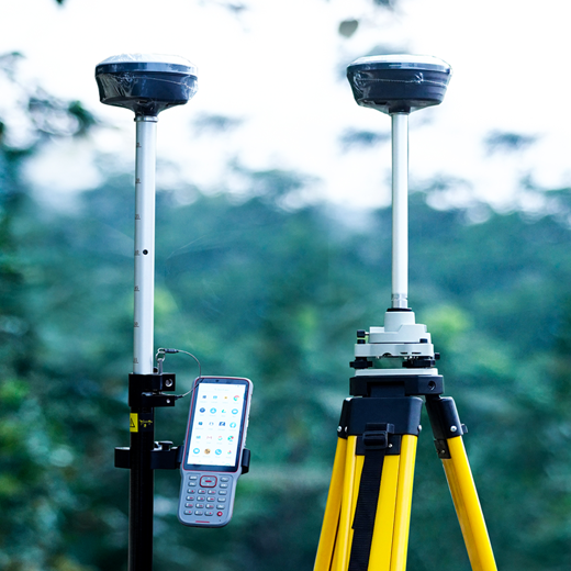
GPS surveying is a quick and accurate way of mapping and modeling the physical world, from mountainous landscapes to city skylines. This versatility and utility are why GPS surveying is the standard practice for any surveying operation. When used by skilled professionals, GPS provides surveying and mapping data of the highest accuracy.
Topographic survey locates all surface features of a property. And depicts all natural features and elevations. In essence, it is a map of a property showing all natural and man-made features and improvements specifically, It shows their location, size, height and any changes in elevation
Land surveying is the art and science of establishing or reestablishing corners, lines, boundaries, and monuments of real property (land) based upon recorded documents, historical evidence, and present standards of practice. Land Surveying also includes associated services such as analysis and utilization of survey data, subdivision planning and design, writing legal descriptions, mapping, construction layout, and precision measurements of angle, length, area, and volume.
Contour Survey is a way to easily visually understand the vertical and horizontal shape of your Land. By understanding the land contours, you can easily visualise how water will flow over the property when it rains
Subdivision survey is performed when a landowner wishes to divide a property into two or more parcels. The result is each new plot will acquire a separate title.
Boundary disputes are a common issue that one faces, especially when you sell or purchase land or when you decide to build a boundary wall / fences. We will refocus your boundary as per earlier official records.
Setting out is a process of transferring the distance from the plan already prepared to the ground before starting a construction .The plans as designed and prepared is set out on the ground in the correct position
We offer well maintained Survey instruments for rent those are in extremely good condition at a very reasonable rate
We also train the student to become a high quality professional surveyor equipped to handle state -of-the-art instruments and software applications .The course is structured as to enable the students to enter the course at different levels depending on the basic qualification attained by them.